National Forest Topo Maps for Every Trail
Build custom, high-resolution USGS topo composites in minutes. Pick your state, select the tiles you need, and download a print-ready map built for the backcountry.
How it works
A simple workflow that gets you into the backcountry faster.
1. Pick a state
Start with the US map and choose a state with National Forest coverage.
2. Select tiles
Click the exact 7.5-minute quads you need. Combine up to 10 tiles per map.
3. Download map
Get a high-resolution, print-ready topo composite in minutes.
See the detail before you buy
Every order starts with a free watermarked preview so you can confirm coverage, trail detail, and contour clarity. Upgrade only when you're ready for a print-ready file.
Our composites stitch USGS 7.5-minute quads into a single seamless map—perfect for planning, route marking, and offline navigation.
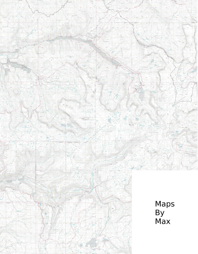
Watermarked preview
Zoom in to inspect trails, contour lines, and landmarks before purchasing the HD file.
Choose a State
Click any highlighted state to explore available forest map tiles.
Browse All States
Simple pricing
Every map starts with a free watermarked preview. Pay only for print-ready HD.
Free Preview
$0
Up to 10 tiles
• Watermarked composite map
• Great for planning & preview
• Instant download
• No account needed
Day Hike
$3.99
1–3 tiles HD
• High-resolution JPEG
• No watermark
• Print-ready quality
• Instant download
Weekend
$7.99
4–7 tiles HD
• High-resolution JPEG
• No watermark
• Print-ready quality
• Covers larger areas
Expedition
$12.99
8–10 tiles HD
• High-resolution JPEG
• No watermark
• Print-ready quality
• Maximum coverage
Frequently Asked Questions
What are USGS topographic maps?
USGS topographic maps are detailed maps showing terrain features, elevation contours, trails, and landmarks. Our maps use official USGS 7.5-minute quadrangle data for accurate backcountry navigation.
How do I download national forest topo maps?
Select your state, click the tiles you need (up to 10), and download a stitched composite map. Every map starts with a free watermarked preview before purchasing the HD version.
What resolution are the maps?
All maps are delivered at 300 DPI in high-resolution JPEG format, optimized for printing and suitable for large-format output up to poster size.
Can I print these maps?
Yes, all maps are print-ready at 300 DPI resolution. Perfect for laminating, framing, or taking into the backcountry for offline navigation and route planning.
How many states are available?
We currently cover 43 states with National Forest lands, including over 9,700 USGS quadrangle tiles. Coverage spans coast to coast with more states coming soon.
Ready to build your custom topo map?
Start with the US map and pick the exact tiles you need.
Start Exploring